The South Australian Government will partner with the SmartSat Collaborative Research Centre (CRC) to deliver two new research projects that will pilot the use of space data and artificial intelligence to enhance environmental monitoring on Earth.
The $500,000 funding commitment will use data captured by South Australian-built satellite, Kanyini, to investigate ways to support government agencies and research institutions in the areas of thermal sensing and biodiversity mapping.
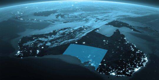
With climate change leading to more severe and frequent heatwaves, one of the projects will use Kanyini’s onboard thermal imagery and AI-based analytics capability to monitor a more current picture of surface temperatures across Adelaide and areas of regional South Australia and how this impacts citizens.
Working with the Department for Environment and Water, the project aims to pilot updated heat maps to enable more adaptive planning and responses to the impacts of heatwaves. This has the potential to aid with infrastructure planning and mitigation strategies, community resilience for heat events and greening investment.
A second project, in collaboration with the Department for Environment and Water and Primary Industries and Regions SA, will pilot new approaches to improve understanding of land-use in South Australia. This enhanced data could be used to help monitor changes in native vegetation cover, crop health and land-use.
Focusing on Kangaroo Island and the Northern pastoral region, Kanyini’s hyperspectral imagery combined with AI-based analytics aims to deliver improved understanding of South Australian native vegetation communities and key species important for carbon sequestration. This has the potential to provide vital insights for farmers and pastoralists to monitor and understand vegetation changes as well as forecast the ecological impacts of future climate conditions.
As the nations’ largest space industry-research collaboration and lead of the Kanyini mission, SmartSat CRC whose activities are funded by the Australian Government’s CRC Program, will steer the projects, helping to deliver key insights and drive better outcomes for South Australian communities.
Kanyini is set to be launched into orbit onboard SpaceX Transporter 11 in July.
Quotes attributable to South Australian Space Industry Centre CE, Matt Opie
Harnessing the power of space data unlocks unprecedented opportunities for us to understand and protect our environment, as well as deliver tangible benefits to our communities.
The Kanyini satellite exemplifies this potential, and these projects will provide critical insights derived from space to help our experts on the ground make informed decisions to tackle environmental management and sustainability challenges.
The State Government is fostering the development of an innovative, thriving and sustainable space sector and our partnership with the SmartSat CRC marks a significant milestone in utilising space technology for environmental benefits here on Earth.
Quotes attributable to SmartSat CRC CEO Professor Andy Koronios
Until now, images of our state have been sourced from foreign satellites, limiting our access to up-to-date, detailed images of areas of interest.
With the Kanyini mission, we are demonstrating the capability to capture images of specific locations tailored to particular applications.
By leveraging advanced data analytics, we have the ability to transform these images into actionable intelligence for state government departments for the benefit of all South Australians.